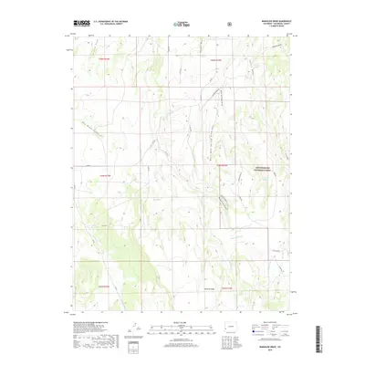
2019 Map of Barkelew Draw
USGS Topo · Published 2019About this map
Hamilton Mesa and the surrounding high country of San Miguel County define this landscape at the edge of the Uncompahgre National Forest. The map documents a complex network of drainage systems, including Barkelew Draw, Mud Springs Draw, and West Mud Spring Draw, which shape the local topography. Human engineering is evident through the presence of the Lilylands Canal and the Two Fork Reservoir, indicating the vital importance of water management in this arid region. The terrain is further divided by the Callan Divide and the deep incision of East Broad Canyon. A sparse but significant road network, including the Norwood Burn Rd and numerous county routes like Co Rd 34Y, provides access through the public lands and forest boundaries, tracing a pattern of land use that balances conservation with local transit needs.
Find a feature on this map
34 named features on this map. Tap any name to fly to it.
Don’t see what you’re looking for? This feature index may not catch every label — zoom into the map to look around manually.
Map Details
Editions of this 2019 Barkelew Draw Map
This is the sole edition of this map. No revisions or reprints were ever made.
Other maps of this area

1916 · Paradox Valley
USGS Topo · 1:125,000

1922 · Paradox Valley
USGS Topo · 1:125,000

1956 · Cortez
USGS Topo · 1:250,000

1956 · Moab
USGS Topo · 1:250,000

1958 · Cortez
USGS Topo · 1:250,000

1959 · Cortez
USGS Topo · 1:250,000

1959 · Moab
USGS Topo · 1:250,000

1960 · Moab
USGS Topo · 1:250,000

1962 · Moab
USGS Topo · 1:250,000

1962 · Cortez
USGS Topo · 1:250,000