
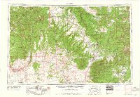
1959 Map of Cortez
USGS Topo · Published 1959About this map
Mesa Verde National Park and the surrounding high desert plateaus define this 1959 survey of the Four Corners region. The landscape transitions from the agricultural pockets around Cortez and Monticello to the deep incisions of the San Juan River and Dolores River. The map provides a clear look at the mid-century infrastructure of the Ute Mountain Indian Reservation and Navajo Indian Reservation, showing the network of roads including US Highway 160 and US Highway 666.
Find a feature on this map
53 named features on this map. Tap any name to fly to it.
Don’t see what you’re looking for? This feature index may not catch every label — zoom into the map to look around manually.
Map Details
Editions of this 1959 Cortez Map
2 editions found
Other maps of this area

1883 · Marsh Pass
USGS Topo · 1:250,000

1885 · San Rafael
USGS Topo · 1:250,000

1885 · La Sal
USGS Topo · 1:250,000

1886 · Henry Mountains
USGS Topo · 1:250,000

1886 · Abajo
USGS Topo · 1:250,000

1889 · Largo
USGS Topo · 1:250,000

1889 · Chaco
USGS Topo · 1:250,000

1892 · Marsh Pass
USGS Topo · 1:250,000

1892 · Abajo
USGS Topo · 1:250,000

1892 · Henry Mountains
USGS Topo · 1:250,000