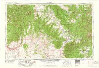
1959 Map of Cortez
USGS Topo · Published 1959About this map
Mesa Verde National Park and the surrounding Four Corners region define this 1959 survey, revealing a landscape of high plateaus and deep canyons at the height of the mid-century Cold War mining boom. While ancient archaeological sites are protected within Hovenweep National Monument and Natural Bridges National Monument, the contemporary economy is marked by industrial activity, specifically the extraction of Uranium and Vanadium. The map documents the sprawling Navajo Indian Reservation and Ute Mountain Indian Reservation, showing the interaction between federal lands and sovereign tribal territories. Water management is critical in this arid environment, evidenced by the San Juan River and Groundhog Reservoir. Settlements like Cortez, Monticello, and Blanding serve as regional hubs connected by a developing network including Us 160 and Us 666, facilitating both the mining industry and early automotive tourism to the region's monuments.
Find a feature on this map
78 named features on this map. Tap any name to fly to it.
Don’t see what you’re looking for? This feature index may not catch every label — zoom into the map to look around manually.
Map Details
Editions of this 1959 Cortez Map
2 editions found

Other maps of this area

1883 · Marsh Pass
USGS Topo · 1:250,000

1885 · San Rafael
USGS Topo · 1:250,000

1885 · La Sal
USGS Topo · 1:250,000

1886 · Henry Mountains
USGS Topo · 1:250,000

1886 · Abajo
USGS Topo · 1:250,000

1889 · Largo
USGS Topo · 1:250,000

1889 · Chaco
USGS Topo · 1:250,000

1892 · Marsh Pass
USGS Topo · 1:250,000

1892 · Abajo
USGS Topo · 1:250,000

1892 · Henry Mountains
USGS Topo · 1:250,000