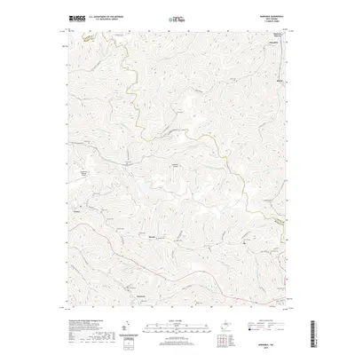
2019 Map of Barnabus
USGS Topo · Published 2019About this map
Hatfield Cem and Chafin Cem sit among the numerous family burial grounds that dot this landscape along the Logan Co and Mingo Co border. The rugged terrain of the Appalachian Plateau is carved by an intricate network of waterways, including Pigeon Creek and Island Creek, which dictate the placement of local infrastructure and settlements. Small communities like Pie, Varney, and Musick are linked by winding roads such as US Rte 52 and Co Hwy 65/03. The presence of the Appalachian Regional Airport and the sprawling residential patterns near Newtown and Stirrat demonstrate how modern development has adapted to the steep hollows and narrow valleys characteristic of southern West Virginia. This 2019 survey provides a detailed look at the persistent genealogical markers, like Duty Cem and Farley Cem, that remain central to the region's identity.
Find a feature on this map
88 named features on this map. Tap any name to fly to it.
Don’t see what you’re looking for? This feature index may not catch every label — zoom into the map to look around manually.
Map Details
Editions of this 2019 Barnabus Map
This is the sole edition of this map. No revisions or reprints were ever made.
Other maps of this area

1887 · Warfield
USGS Topo · 1:125,000

1891 · Oceana
USGS Topo · 1:125,000

1891 · Warfield
USGS Topo · 1:125,000

1893 · Oceana
USGS Topo · 1:125,000

1898 · Oceana
USGS Topo · 1:125,000

1909 · Matewan
USGS Topo · 1:48,000

1909 · Gilbert
USGS Topo · 1:48,000

1910 · Holden
USGS Topo · 1:48,000

1912 · Gilbert
USGS Topo · 1:62,500

1912 · Holden
USGS Topo · 1:62,500