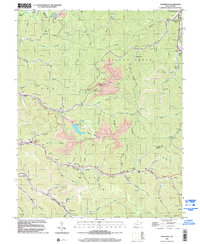
1996 Map of Barnabus
USGS Topo · Published 2002About this map
Deep-cut hollows and heavy industrial activity define this landscape along the Logan Co and Mingo Co line during the late twentieth century. Centered on the winding waters of Island Creek, the terrain shows extensive Strip Mine operations that have reshaped the ridges between Cow Creek and Rockhouse Fork. The region is a patchwork of small mining settlements and family landmarks, with Superior Bottom, Barnabus, and Stirrat clustered in the northern corridor.
Find a feature on this map
67 named features on this map. Tap any name to fly to it.
Don’t see what you’re looking for? This feature index may not catch every label — zoom into the map to look around manually.
Map Details
Editions of this 1996 Barnabus Map
This is the sole edition of this map. No revisions or reprints were ever made.
Other maps of this area

1887 · Warfield
USGS Topo · 1:125,000

1891 · Oceana
USGS Topo · 1:125,000

1891 · Warfield
USGS Topo · 1:125,000

1893 · Oceana
USGS Topo · 1:125,000

1898 · Oceana
USGS Topo · 1:125,000

1909 · Matewan
USGS Topo · 1:48,000

1909 · Gilbert
USGS Topo · 1:48,000

1910 · Holden
USGS Topo · 1:48,000

1912 · Gilbert
USGS Topo · 1:62,500

1912 · Holden
USGS Topo · 1:62,500