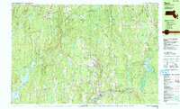
1988 Map of Barre
USGS Topo · Published 1988About this map
The eastern reaches of the Quabbin Reservoir dominate the western landscape of this Worcester County survey, revealing the flooded terrain where the East Branch Swift River and Pottapaug Pond meet. The map documents a rural transition where the industrial legacies of the Ware River valley, seen at South Barre and Barre Plains, give way to the extensive protected woodlands of the Harvard Forest and Hubbardston State Forest.
Find a feature on this map
100 named features on this map. Tap any name to fly to it.
Don’t see what you’re looking for? This feature index may not catch every label — zoom into the map to look around manually.
Map Details
Editions of this 1988 Barre Map
2 editions found
Other maps of this area

1885 · Worcester
USGS Topo · 1:62,500

1886 · Worcester
USGS Topo · 1:62,500

1887 · Warwick
USGS Topo · 1:62,500

1887 · Belchertown
USGS Topo · 1:62,500

1887 · Winchendon
USGS Topo · 1:62,500

1887 · Barre
USGS Topo · 1:62,500

1887 · Fitchburg
USGS Topo · 1:62,500

1889 · Fitchburg
USGS Topo · 1:62,500

1889 · Barre
USGS Topo · 1:62,500

1889 · Warwick
USGS Topo · 1:62,500