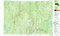
1988 Map of Barre
USGS Topo · Published 1988About this map
The Quabbin Reservoir defines the western edge of this 1980s terrain, marking a landscape reshaped by twentieth-century water management. At its shores, the remaining footprint of Dana Center and the East Branch Swift River illustrate the area's transition into a protected watershed. Further east, the Ware River winds through industrial and civic centers like South Barre and Barre Plains, where the Boston and Maine Railroad corridors still trace the valley floor. Genealogy and local history researchers will find a dense network of family and community sites, including the Milos Holden Cem, Coldbrook Cem, and the Marie Assumpta Academy. The landscape is characterized by numerous protected lands, from the Phillipston State Wildlife Management Area to the Federated Womens Club State Forest, preserving a quiet New England geography of drumlins and mill ponds.
Find a feature on this map
83 named features on this map. Tap any name to fly to it.
Don’t see what you’re looking for? This feature index may not catch every label — zoom into the map to look around manually.
Map Details
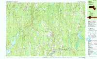
Editions of this 1988 Barre Map
2 editions found
Other maps of this area

1885 · Worcester
USGS Topo · 1:62,500

1886 · Worcester
USGS Topo · 1:62,500

1887 · Warwick
USGS Topo · 1:62,500

1887 · Belchertown
USGS Topo · 1:62,500

1887 · Winchendon
USGS Topo · 1:62,500

1887 · Barre
USGS Topo · 1:62,500

1887 · Fitchburg
USGS Topo · 1:62,500

1889 · Fitchburg
USGS Topo · 1:62,500

1889 · Barre
USGS Topo · 1:62,500

1889 · Warwick
USGS Topo · 1:62,500