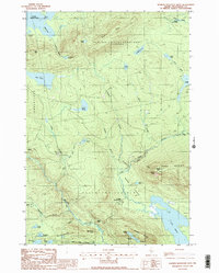
1988 Map of Barren Mountain West
USGS Topo · Published 1988About this map
Bowdoin College Grant West defines much of this northern Maine landscape, illustrating the historical intersection of higher education land grants and timber management. The terrain is dominated by the massive profile of Barren Mountain, where the Appalachian National Scenic Trail winds past notable geological features like Barren Slide and Barren Ledges. The drainage network is complex, centering on Big Wilson Stream and its tributaries, which once supported the remote logging operations evidenced by St Regis Depot Camp and Camp Twelve.
Find a feature on this map
55 named features on this map. Tap any name to fly to it.
Don’t see what you’re looking for? This feature index may not catch every label — zoom into the map to look around manually.
Map Details
Editions of this 1988 Barren Mountain West Map
2 editions found
Other maps of this area

1920 · Moosehead Lake
USGS Topo · 1:62,500

1922 · Moosehead Lake
USGS Topo · 1:62,500

1930 · Moosehead Lake
USGS Topo · 1:62,500

1944 · Moosehead Lake
USGS Topo · 1:62,500

1950 · Sebec Lake
USGS Topo · 1:62,500

1951 · Greenville
USGS Topo · 1:62,500

1952 · First Roach Pond
USGS Topo · 1:62,500

1954 · Millinocket
USGS Topo · 1:250,000

1957 · Moosehead Lake
USGS Topo · 1:62,500

1958 · Millinocket
USGS Topo · 1:250,000
Featured Places
- Greenville, ME
- Bowdoin College Grant West Township, ME
- Elliottsville Township, ME
- Piscataquis County, ME
- United States