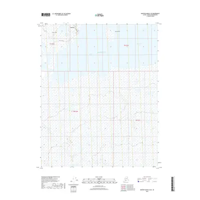
2018 Map of Barter Island A-5 SE
USGS Topo · Published 2018About this map
Kaktovik sits at the edge of the Beaufort Sea on the northern coast of Barter Island, representing a vital human presence in the Arctic landscape of the North Slope Borough. This 2018 survey documents the organized street grid of the settlement, including Hula Hula Avenue and Okpik Avenue, positioned between the open sea and the protected waters of Kaktovik Lagoon. The landscape is dominated by the intricate relationship between land and water, with landforms like Manning Point and the expansive Jago Lagoon defining the shoreline. The map reveals the extensive wetland networks that characterize this tundra environment, showing how the community is physically bounded by the lagoons and the Beaufort Sea.
Find a feature on this map
12 named features on this map. Tap any name to fly to it.
Don’t see what you’re looking for? This feature index may not catch every label — zoom into the map to look around manually.
Map Details
Editions of this 2018 Barter Island A-5 SE Map
This is the sole edition of this map. No revisions or reprints were ever made.
Other maps of this area

1951 · Barter Island
USGS Topo · 1:250,000

1951 · Demarcation Point
USGS Topo · 1:250,000

1955 · Demarcation Point
USGS Topo · 1:250,000

1955 · Barter Island A-5
USGS Topo · 1:63,360

1955 · Barter Island A-4
USGS Topo · 1:63,360

1955 · Demarcation Point D-5
USGS Topo · 1:63,360

1955 · Demarcation Point D-4
USGS Topo · 1:63,360

1959 · Barter Island
USGS Topo · 1:250,000

1964 · Demarcation Point
USGS Topo · 1:250,000
1964 · Barter Island
USGS Topo · 1:250,000