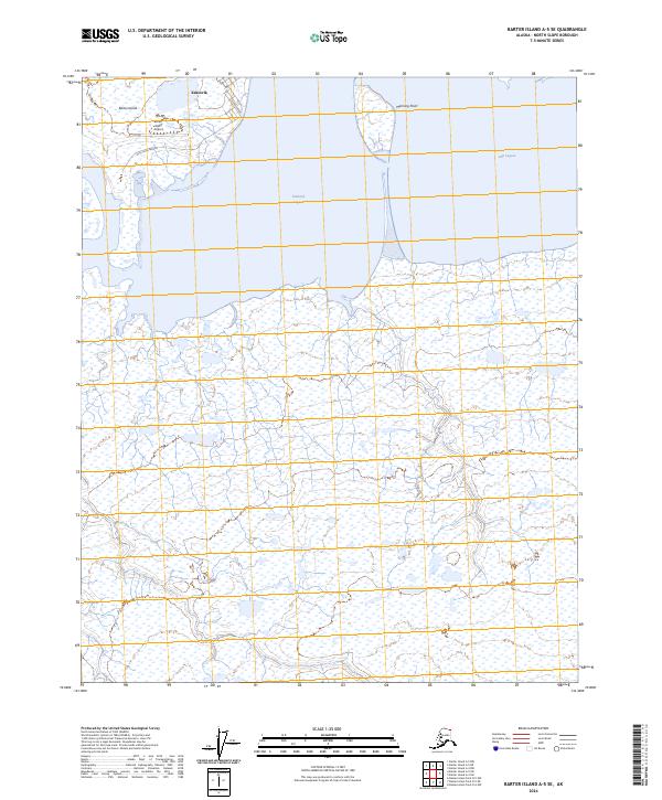
2024 Map of Barter Island A-5 SE
USGS Topo · Published 2024About this map
Kaktovik serves as the primary hub of human activity on this map of the Alaskan Beaufort Sea coast, situated on the northern edge of Barter Island. The settlement's layout is defined by thoroughfares such as Okpik Avenue and Hula Hula Avenue, providing essential connectivity to the Barter Island Airport. This coastal landscape is shaped by the protective barriers of Manning Point, which separate the mainland from the waters of Kaktovik Lagoon and Jago Lagoon.
Find a feature on this map
13 named features on this map. Tap any name to fly to it.
Don’t see what you’re looking for? This feature index may not catch every label — zoom into the map to look around manually.
Map Details
Editions of this 2024 Barter Island A-5 SE Map
This is the sole edition of this map. No revisions or reprints were ever made.
Other maps of this area

1951 · Barter Island
USGS Topo · 1:250,000

1951 · Demarcation Point
USGS Topo · 1:250,000

1955 · Demarcation Point
USGS Topo · 1:250,000

1955 · Barter Island A-5
USGS Topo · 1:63,360

1955 · Barter Island A-4
USGS Topo · 1:63,360

1955 · Demarcation Point D-5
USGS Topo · 1:63,360

1955 · Demarcation Point D-4
USGS Topo · 1:63,360

1959 · Barter Island
USGS Topo · 1:250,000

1964 · Demarcation Point
USGS Topo · 1:250,000
1964 · Barter Island
USGS Topo · 1:250,000