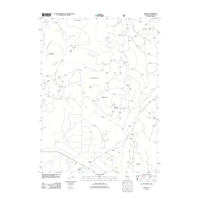
2012 Map of Bartle
USGS Topo · Published 2012About this map
The McCloud River flows through the southern reaches of this landscape, anchoring the settlement of Bartle and the nearby landmark of Coney Island. The terrain is defined by its network of water sources and forestry outposts, including McKay Springs, Slagger Spring, and Red Tank Spring. These features supported the seasonal camps and administrative points throughout the volcanic topography of the southern Cascades, such as Slagger Camp and Shirttail Camp.
Find a feature on this map
35 named features on this map. Tap any name to fly to it.
Don’t see what you’re looking for? This feature index may not catch every label — zoom into the map to look around manually.
Map Details
Editions of this 2012 Bartle Map
This is the sole edition of this map. No revisions or reprints were ever made.
Other maps of this area

1886 · Modoc Lava Bed
USGS Topo · 1:250,000

1892 · Modoc Lava-Bed
USGS Topo · 1:250,000

1932 · Bartle
USGS Topo · 1:96,000

1939 · Bartle
USGS Topo · 1:125,000

1954 · Alturas
USGS Topo · 1:250,000

1958 · Alturas
USGS Topo · 1:250,000

1961 · Hambone
USGS Topo · 1:62,500

1961 · Pondosa
USGS Topo · 1:62,500
1961 · Big Bend
USGS Topo · 1:62,500

1961 · Bartle
USGS Topo · 1:62,500