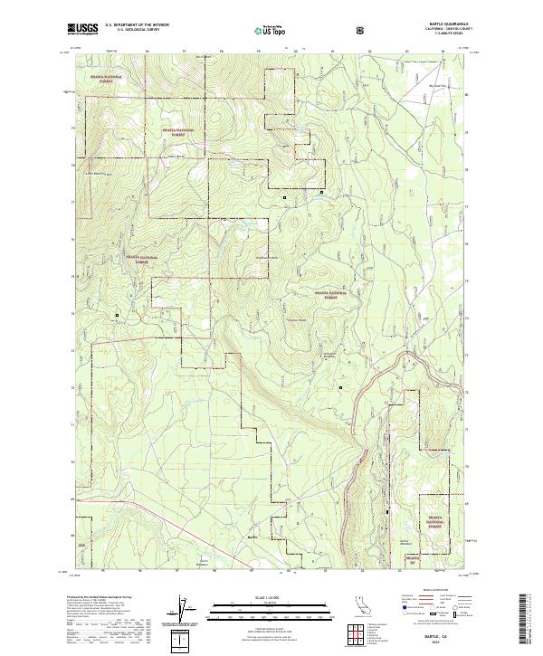
2021 Map of Bartle
USGS Topo · Published 2021About this map
Bartle sits at a historic crossroads in the southern reaches of the Shasta National Forest, where high-elevation meadows and volcanic buttes dominate the landscape. This 2021 survey illustrates a region defined by its timber and water resources, with the McCloud River and Bartle Creek flowing through the southern portion of the quadrangle. The map captures the specialized geography of the region, from the open expanses of Stillwater Meadows and Atkins Meadows to prominent heights like Sheepheaven Butte and Buck Mountain.
Find a feature on this map
34 named features on this map. Tap any name to fly to it.
Don’t see what you’re looking for? This feature index may not catch every label — zoom into the map to look around manually.
Map Details
Editions of this 2021 Bartle Map
This is the sole edition of this map. No revisions or reprints were ever made.
Other maps of this area

1886 · Modoc Lava Bed
USGS Topo · 1:250,000

1892 · Modoc Lava-Bed
USGS Topo · 1:250,000

1932 · Bartle
USGS Topo · 1:96,000

1939 · Bartle
USGS Topo · 1:125,000

1954 · Alturas
USGS Topo · 1:250,000

1958 · Alturas
USGS Topo · 1:250,000

1961 · Hambone
USGS Topo · 1:62,500

1961 · Pondosa
USGS Topo · 1:62,500
1961 · Big Bend
USGS Topo · 1:62,500

1961 · Bartle
USGS Topo · 1:62,500