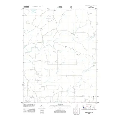
2010 Map of Bartlettsville
USGS Topo · Published 2010About this map
Bartlettsville and the surrounding Lawrence County uplands are defined by a complex network of creeks and small family-named settlements. The landscape transitions from the edge of Monroe Lake in the north through the drainage basins of Wolf Creek, Salt Creek, and Little Salt Creek. These waterways, along with Brewer Branch and Pleasant Run, have historically dictated the placement of rural roads like Guthrie Rd and Bartlettsville Rd.
Find a feature on this map
70 named features on this map. Tap any name to fly to it.
Don’t see what you’re looking for? This feature index may not catch every label — zoom into the map to look around manually.
Map Details
Editions of this 2010 Bartlettsville Map
This is the sole edition of this map. No revisions or reprints were ever made.
Other maps of this area

1908 · Bloomington
USGS Topo · 1:48,000

1910 · Bloomington
USGS Topo · 1:62,500

1934 · Bedford
USGS Topo · 1:48,000

1935 · Oolitic
USGS Topo · 1:48,000

1937 · Bedford
USGS Topo · 1:62,500

1942 · Franklin
USGS Topo · 1:125,000

1942 · Oolitic
USGS Topo · 1:62,500

1947 · Allens Creek
USGS Topo · 1:24,000

1947 · Elkinsville
USGS Topo · 1:24,000
1950 · Elkinsville
USGS Topo · 1:24,000