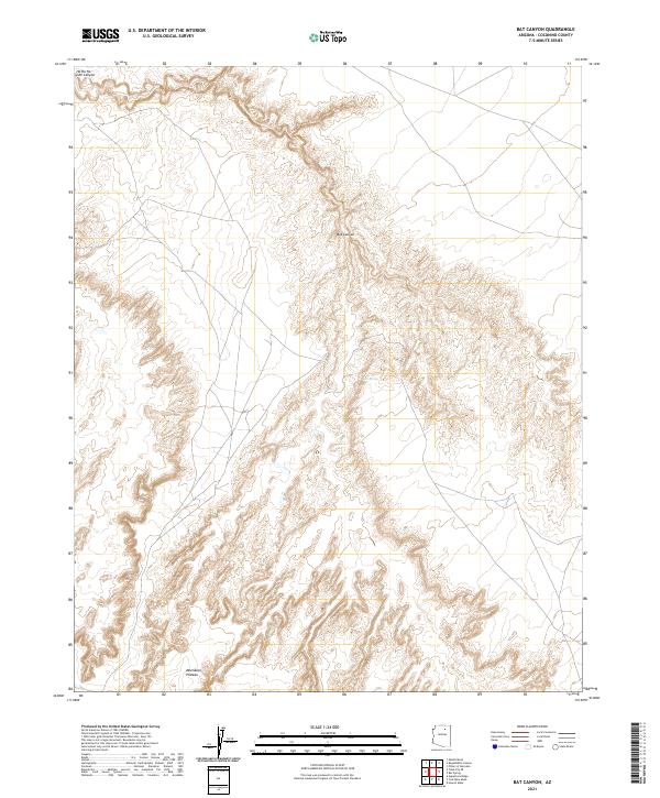
2021 Map of Bat Canyon
USGS Topo · Published 2021About this map
Moenkopi Plateau dominates the southern reaches of this landscape, its elevated surface giving way to a complex network of erosional features. The terrain is defined by dramatic topographical shifts where the high plateau drops into deeply incised drainages, most notably the namesake Bat Canyon. This area reflects the characteristic geomorphology of the region, where water, though scarce, has shaped the earth over millennia. A rare water source, Nez Spring, is documented in the central portion of the map, providing a vital point of interest in an otherwise arid environment. The northern edge of the sheet is marked by the winding path of Ha Ho No Geh Canyon, another significant drainage system that illustrates the intricate natural carving of the Coconino County high desert.
Find a feature on this map
11 named features on this map. Tap any name to fly to it.
Don’t see what you’re looking for? This feature index may not catch every label — zoom into the map to look around manually.
Map Details
Editions of this 2021 Bat Canyon Map
This is the sole edition of this map. No revisions or reprints were ever made.
Other maps of this area

1883 · Marsh Pass
USGS Topo · 1:250,000

1883 · Tusayan
USGS Topo · 1:250,000

1886 · Tusayan
USGS Topo · 1:250,000

1886 · San Francisco Mtns
USGS Topo · 1:250,000

1886 · Echo Cliffs
USGS Topo · 1:250,000

1891 · San Francisco Mtns
USGS Topo · 1:250,000

1891 · Echo Cliffs
USGS Topo · 1:250,000

1892 · Marsh Pass
USGS Topo · 1:250,000

1894 · San Francisco Mtns
USGS Topo · 1:250,000

1899 · San Francisco Mtns
USGS Topo · 1:250,000