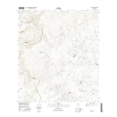
2016 Map of Bat Cave
USGS Topo · Published 2016About this map
Garden Ridge and the historic corridor along FM 3009 anchor this transition between the suburban sprawl of the San Antonio area and the more rural terrain to the north. The landscape is defined by the winding course of Cibolo Cr and Bear Cr, punctuated by a significant concentration of family burial grounds that hint at the region's deep agricultural roots. Genealogists can locate several small plots, including Gerhardt Cem, Hillert Cem, and Kunkel Cem, which remain as markers of early landholdings.
Find a feature on this map
120 named features on this map. Tap any name to fly to it.
Don’t see what you’re looking for? This feature index may not catch every label — zoom into the map to look around manually.
Map Details
Editions of this 2016 Bat Cave Map
This is the sole edition of this map. No revisions or reprints were ever made.
Other maps of this area

1920 · Smithsons Valley
USGS Topo · 1:62,500

1925 · Hunter No 3
USGS Topo · 1:48,000

1927 · New Braunfels
USGS Topo · 1:62,500

1927 · Smithson Valley
USGS Topo · 1:62,500

1929 · Hunter
USGS Topo · 1:62,500

1929 · Smithson Valley
USGS Topo · 1:62,500

1940 · Smithson Valley
USGS Topo · 1:62,500

1953 · Schertz
USGS Topo · 1:24,000

1953 · Bulverde
USGS Topo · 1:24,000

1953 · Bat Cave
USGS Topo · 1:24,000