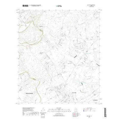
2019 Map of Bat Cave
USGS Topo · Published 2019About this map
Bulverde and the northern outskirts of San Antonio anchor this 2019 look at the Comal and Bexar County line. The landscape is defined by the winding drainages of Cibolo Creek, Dry Comal Creek, and Bear Creek, which cut through the limestone terrain of the Texas Hill Country. For genealogists, the map is remarkably detailed in its preservation of family-named cemeteries such as Hillert Cemetery, Gerhardt Cemetery, and Kunkel Cemetery, which sit alongside modern residential growth in Garden Ridge and Schertz.
Find a feature on this map
125 named features on this map. Tap any name to fly to it.
Don’t see what you’re looking for? This feature index may not catch every label — zoom into the map to look around manually.
Map Details
Editions of this 2019 Bat Cave Map
This is the sole edition of this map. No revisions or reprints were ever made.
Other maps of this area

1920 · Smithsons Valley
USGS Topo · 1:62,500

1925 · Hunter No 3
USGS Topo · 1:48,000

1927 · New Braunfels
USGS Topo · 1:62,500

1927 · Smithson Valley
USGS Topo · 1:62,500

1929 · Hunter
USGS Topo · 1:62,500

1929 · Smithson Valley
USGS Topo · 1:62,500

1940 · Smithson Valley
USGS Topo · 1:62,500

1953 · Schertz
USGS Topo · 1:24,000

1953 · Bulverde
USGS Topo · 1:24,000

1953 · Bat Cave
USGS Topo · 1:24,000