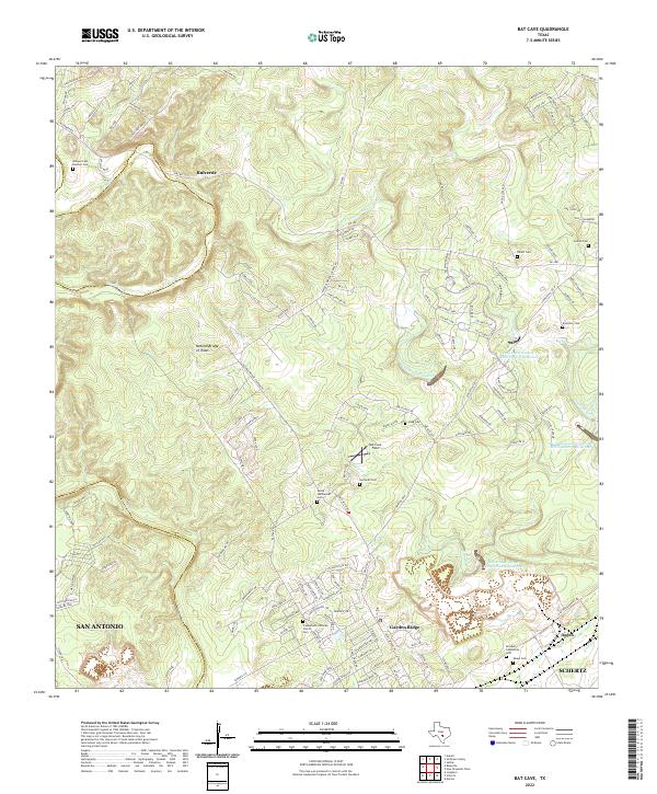
2022 Map of Bat Cave
USGS Topo · Published 2022About this map
The rugged karst landscape of the Comal and Bexar county line is defined by dramatic subterranean features and scattered family history. Natural Bridge of Texas and Bat Cave Field anchor a terrain carved by the Cibolo Cr and the W Fork Dry Comal Cr. This area, while seeing modern growth in Garden Ridge and near the San Antonio city limits, retains a dense network of private family burial grounds that speak to its early settlement. Genealogists can trace numerous pioneer names through sites like the Jacob Wellbacher Cem, Bracken Community Cem, and the Römpel Cem Number One. The map also illustrates water management efforts through several reservoirs, including Soil Conservation Service Site 4 Reservoir, which manage runoff through the complex creek systems feeding into Schertz.
Find a feature on this map
141 named features on this map. Tap any name to fly to it.
Don’t see what you’re looking for? This feature index may not catch every label — zoom into the map to look around manually.
Map Details
Editions of this 2022 Bat Cave Map
This is the sole edition of this map. No revisions or reprints were ever made.
Other maps of this area

1920 · Smithsons Valley
USGS Topo · 1:62,500

1925 · Hunter No 3
USGS Topo · 1:48,000

1927 · New Braunfels
USGS Topo · 1:62,500

1927 · Smithson Valley
USGS Topo · 1:62,500

1929 · Hunter
USGS Topo · 1:62,500

1929 · Smithson Valley
USGS Topo · 1:62,500

1940 · Smithson Valley
USGS Topo · 1:62,500

1953 · Schertz
USGS Topo · 1:24,000

1953 · Bulverde
USGS Topo · 1:24,000

1953 · Bat Cave
USGS Topo · 1:24,000