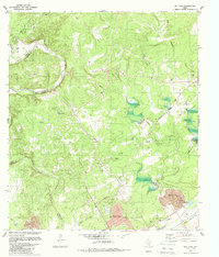
1988 Map of Bat Cave
USGS Topo · Published 1988About this map
Natural Bridge Caverns and the namesake Bat Cave highlight the subterranean geological character of the Texas Hill Country along the Comal Co Bexar Co border. This late 1980s revision, produced by the U.S. Geological Survey in cooperation with the Texas Water Development Board, documents a landscape of limestone drainage systems including Cibolo Creek, Bear Creek, and Comal Creek. The settlement of Garden Ridge appears as a growing focal point near the southern margin, anchored by its City Hall, while the smaller community of Ogden sits to the southeast.
Find a feature on this map
39 named features on this map. Tap any name to fly to it.
Don’t see what you’re looking for? This feature index may not catch every label — zoom into the map to look around manually.
Map Details
Editions of this 1988 Bat Cave Map
This is the sole edition of this map. No revisions or reprints were ever made.
Other maps of this area

1920 · Smithsons Valley
USGS Topo · 1:62,500

1925 · Hunter No 3
USGS Topo · 1:48,000

1927 · New Braunfels
USGS Topo · 1:62,500

1927 · Smithson Valley
USGS Topo · 1:62,500

1929 · Hunter
USGS Topo · 1:62,500

1929 · Smithson Valley
USGS Topo · 1:62,500

1940 · Smithson Valley
USGS Topo · 1:62,500

1953 · Schertz
USGS Topo · 1:24,000

1953 · Bulverde
USGS Topo · 1:24,000

1953 · Bat Cave
USGS Topo · 1:24,000