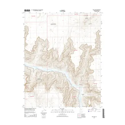
2014 Map of Bat Cave
USGS Topo · Published 2014About this map
Grand Canyon National Park meets the Lake Mead National Recreation Area in this Mohave County landscape where the river transitions from canyon to reservoir. The eponymous Bat Cave is situated on the northern cliffs overlooking the Colorado River, a site of significant historical interest for guano mining operations during the mid-20th century. To the north, the Upper Grand Wash Cliffs and Fort Garrett Point define the southern edge of the Sanup Plateau. Further south, the map details the winding course of the Colorado River as it enters Lake Mead near the Lower Granite Gorge. This topographical study illustrates the complex drainage patterns of Tincanebits Canyon and Dry Canyon, showcasing the dramatic verticality where high desert plateaus drop toward the river floor.
Find a feature on this map
17 named features on this map. Tap any name to fly to it.
Don’t see what you’re looking for? This feature index may not catch every label — zoom into the map to look around manually.
Map Details
Editions of this 2014 Bat Cave Map
This is the sole edition of this map. No revisions or reprints were ever made.
Other maps of this area

1886 · Diamond Creek
USGS Topo · 1:250,000

1886 · Mt. Trumbull
USGS Topo · 1:250,000

1892 · Diamond Creek
USGS Topo · 1:250,000

1892 · Mt. Trumbull
USGS Topo · 1:250,000

1948 · Williams
USGS Topo · 1:250,000

1953 · Grand Canyon
USGS Topo · 1:250,000

1954 · Williams
USGS Topo · 1:250,000

1956 · Williams
USGS Topo · 1:250,000

1957 · Grand Canyon
USGS Topo · 1:250,000

1958 · Grand Canyon
USGS Topo · 1:250,000