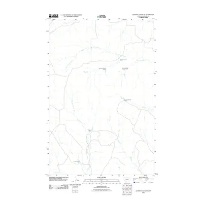
2011 Map of Bateman Coulee NE
USGS Topo · Published 2011About this map
Woody Creek and its tributaries define the drainages of this Garfield County landscape, where water management is central to the land's utility. The drainage system of East Fork Woody Creek is marked by a series of numbered water control structures, including Big Bucks Number 9 Dam and Big Bucks Number 8 Dam, indicating a coordinated approach to ranching or land management in this arid region. Further south, the map identifies Binions Reservoir Number 2 Dam and Big Bucks Number 7 Dam along the contours of the coulees. This network of small-scale dams and reservoirs, such as Fellman Dam on First Creek and the Jim Bob Number 1 Dam further downstream, illustrates the critical importance of seasonal water retention in the eastern Montana plains.
Find a feature on this map
11 named features on this map. Tap any name to fly to it.
Don’t see what you’re looking for? This feature index may not catch every label — zoom into the map to look around manually.
Map Details
Editions of this 2011 Bateman Coulee NE Map
This is the sole edition of this map. No revisions or reprints were ever made.
Other maps of this area

1954 · Jordan
USGS Topo · 1:250,000

1956 · Jordan
USGS Topo · 1:250,000

1958 · Jordan
USGS Topo · 1:250,000

1964 · Jordan
USGS Topo · 1:250,000

1964 · Ada Creek
USGS Topo · 1:24,000

1964 · Bateman Coulee
USGS Topo · 1:24,000

1964 · Black John Coulee
USGS Topo · 1:24,000

1964 · Bateman Coulee NE
USGS Topo · 1:24,000

1967 · Hagen Gap
USGS Topo · 1:24,000
1967 · Maxwell Coulee
USGS Topo · 1:24,000