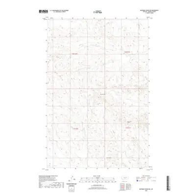
2020 Map of Bateman Coulee NE
USGS Topo · Published 2020About this map
Seven Tree Coulee and numerous other seasonal drainages define this portion of Garfield County, where the landscape is marked by the intricate erosional patterns characteristic of the northern plains. The topographic detail reveals the complex network of draws and breaks that feed into E Fork Woody Cr and Spring Coulee. This 2020 survey demonstrates the persistent rural character of the region, where land management is organized by the Public Land Survey System as shown by the townships of t20n r40e and t20n r41e. The placement of intermittent water sources like Kelly Cr and Sonny Coulee highlights the importance of reliable water in this high-plains environment, an essential factor for the ranching operations that have historically utilized these drainages for livestock.
Find a feature on this map
11 named features on this map. Tap any name to fly to it.
Don’t see what you’re looking for? This feature index may not catch every label — zoom into the map to look around manually.
Map Details
Editions of this 2020 Bateman Coulee NE Map
This is the sole edition of this map. No revisions or reprints were ever made.
Other maps of this area

1954 · Jordan
USGS Topo · 1:250,000

1956 · Jordan
USGS Topo · 1:250,000

1958 · Jordan
USGS Topo · 1:250,000

1964 · Jordan
USGS Topo · 1:250,000

1964 · Ada Creek
USGS Topo · 1:24,000

1964 · Bateman Coulee
USGS Topo · 1:24,000

1964 · Black John Coulee
USGS Topo · 1:24,000

1964 · Bateman Coulee NE
USGS Topo · 1:24,000

1967 · Hagen Gap
USGS Topo · 1:24,000
1967 · Maxwell Coulee
USGS Topo · 1:24,000