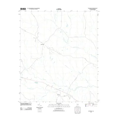
2011 Map of Batesville
USGS Topo · Published 2011About this map
Batesville serves as the focal point for this corner of Barbour County, where the settlement is defined by its position along the South Fork Cowikee Creek. The landscape is a network of watercourses, including Bear Creek, Wilburn Creek, and Bronson Creek, which converge as they move through the terrain toward the larger forks of the Cowikee. Just outside the main settlement, Friendship Cemetery provides a tangible link to the area's local history and family lineages. To the northwest, the community of Spring Hill is situated among several local thoroughfares such as Spring Hill Rd and Co Rd 49. Notable landmarks like Dismukes Pond and the branching paths of Upshur Branch highlight the importance of water management and natural drainage in this rural Alabama landscape during the early 21st century.
Find a feature on this map
24 named features on this map. Tap any name to fly to it.
Don’t see what you’re looking for? This feature index may not catch every label — zoom into the map to look around manually.
Map Details
Editions of this 2011 Batesville Map
This is the sole edition of this map. No revisions or reprints were ever made.
Other maps of this area

1953 · Dothan
USGS Topo · 1:250,000

1954 · Dothan
USGS Topo · 1:250,000

1955 · Dothan
USGS Topo · 1:250,000

1955 · Phenix City
USGS Topo · 1:250,000

1957 · Phenix City
USGS Topo · 1:250,000
1957 · Pittsview
USGS Topo · 1:24,000

1958 · Phenix City
USGS Topo · 1:250,000

1968 · Eufaula North
USGS Topo · 1:24,000

1968 · White Oak
USGS Topo · 1:24,000

1968 · Clayton North
USGS Topo · 1:24,000