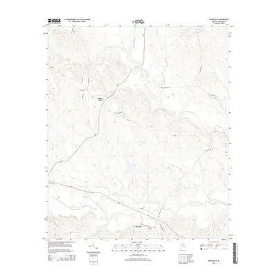
2014 Map of Batesville
USGS Topo · Published 2014About this map
Batesville and Spring Hill anchor this rural landscape in Barbour County, where the terrain is deeply etched by the headwaters of the Cowikee Creek system. The map reveals a complex network of watercourses, including the Middle Fork Cowikee Cr and the winding South Fork Cowikee Creek. Between these forks, the land is defined by numerous ridges and small hollows, drained by tributaries like Wilburn Cr and Bear Cr. Near the intersection of Us-82 and CR-79, the Friendship Cem stands as a significant landmark for genealogical research. The map also documents a high density of named local roads, such as Woody Johnson Rd and Elijah Franklin Rd, which trace the historical property boundaries and transit routes through this agricultural and timber-producing region.
Find a feature on this map
30 named features on this map. Tap any name to fly to it.
Don’t see what you’re looking for? This feature index may not catch every label — zoom into the map to look around manually.
Map Details
Editions of this 2014 Batesville Map
This is the sole edition of this map. No revisions or reprints were ever made.
Other maps of this area

1953 · Dothan
USGS Topo · 1:250,000

1954 · Dothan
USGS Topo · 1:250,000

1955 · Dothan
USGS Topo · 1:250,000

1955 · Phenix City
USGS Topo · 1:250,000

1957 · Phenix City
USGS Topo · 1:250,000
1957 · Pittsview
USGS Topo · 1:24,000

1958 · Phenix City
USGS Topo · 1:250,000

1968 · Eufaula North
USGS Topo · 1:24,000

1968 · White Oak
USGS Topo · 1:24,000

1968 · Clayton North
USGS Topo · 1:24,000