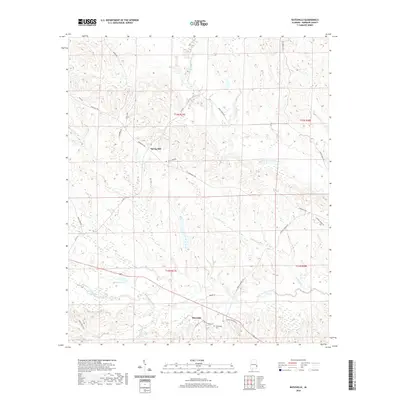
2020 Map of Batesville
USGS Topo · Published 2020About this map
Batesville and Spring Hill anchor this rural landscape in Barbour County, where the topography is defined by the winding drainages of the Cowikee Creek system. The area is characterized by a dense network of country roads named for local families and landmarks, such as Mary C Smith Rd, George Morris Rd, and Woody Johnson Rd, reflecting a deeply rooted community structure. Significant water features include the Middle Fork Cowikee Cr and the South Fork Cowikee Creek, which are fed by smaller tributaries like Upshur Br and Wilburn Cr. Near the settlement of Batesville, the Friendship Cem serves as a primary genealogical landmark. The presence of Dismukes Pond and numerous smaller wetlands along the creek bottoms suggests a terrain historically shaped by both natural hydrology and local land management for agriculture or timber.
Find a feature on this map
31 named features on this map. Tap any name to fly to it.
Don’t see what you’re looking for? This feature index may not catch every label — zoom into the map to look around manually.
Map Details
Editions of this 2020 Batesville Map
This is the sole edition of this map. No revisions or reprints were ever made.
Other maps of this area

1953 · Dothan
USGS Topo · 1:250,000

1954 · Dothan
USGS Topo · 1:250,000

1955 · Dothan
USGS Topo · 1:250,000

1955 · Phenix City
USGS Topo · 1:250,000

1957 · Phenix City
USGS Topo · 1:250,000
1957 · Pittsview
USGS Topo · 1:24,000

1958 · Phenix City
USGS Topo · 1:250,000

1968 · Eufaula North
USGS Topo · 1:24,000

1968 · White Oak
USGS Topo · 1:24,000

1968 · Clayton North
USGS Topo · 1:24,000