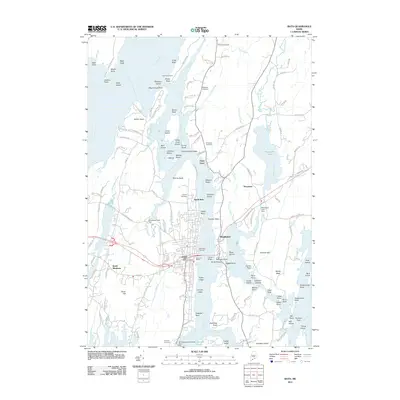
2011 Map of Bath
USGS Topo · Published 2011About this map
Bath’s industrial and maritime identity is defined by the massive Bath Iron Works complex on the banks of the Kennebec River. This 2011 survey illustrates the city’s complex relationship with the water, where the Carlton Bridge and Wilder Bridge connect the shipbuilding hub to Woolwich. The landscape is a intricate network of points, necks, and islands, from Thorne Head in the north to Hospital Point and Doubling Point downstream.
Find a feature on this map
150 named features on this map. Tap any name to fly to it.
Don’t see what you’re looking for? This feature index may not catch every label — zoom into the map to look around manually.
Map Details
Editions of this 2011 Bath Map
This is the sole edition of this map. No revisions or reprints were ever made.
Other maps of this area

1892 · Gardiner
USGS Topo · 1:62,500

1893 · Wiscasset
USGS Topo · 1:62,500

1893 · Boothbay
USGS Topo · 1:62,500

1894 · Bath
USGS Topo · 1:62,500

1920 · Bath
USGS Topo · 1:62,500

1941 · Boothbay
USGS Topo · 1:62,500

1943 · Gardiner
USGS Topo · 1:62,500

1943 · Boothbay
USGS Topo · 1:62,500

1944 · Wiscasset
USGS Topo · 1:62,500

1944 · Boothbay
USGS Topo · 1:62,500