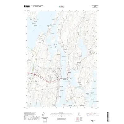
2021 Map of Bath
USGS Topo · Published 2021About this map
Kennebec River maritime geography defines this coastal Maine landscape, where tidal waters converge at Merrymeeting Bay and exit through the narrow The Chops Passage. The city of Bath occupies the western bank, its urban grid and riverside infrastructure including the Sagadahoc Brg and Carlton Bridge crossing toward Woolwich. This 2021 survey reveals a high density of genealogical landmarks, such as Oak Grove Cem, Dummer Street Cem, and Nequasset Cem.
Find a feature on this map
192 named features on this map. Tap any name to fly to it.
Don’t see what you’re looking for? This feature index may not catch every label — zoom into the map to look around manually.
Map Details
Editions of this 2021 Bath Map
This is the sole edition of this map. No revisions or reprints were ever made.
Other maps of this area

1892 · Gardiner
USGS Topo · 1:62,500

1893 · Wiscasset
USGS Topo · 1:62,500

1893 · Boothbay
USGS Topo · 1:62,500

1894 · Bath
USGS Topo · 1:62,500

1920 · Bath
USGS Topo · 1:62,500

1941 · Boothbay
USGS Topo · 1:62,500

1943 · Gardiner
USGS Topo · 1:62,500

1943 · Boothbay
USGS Topo · 1:62,500

1944 · Wiscasset
USGS Topo · 1:62,500

1944 · Boothbay
USGS Topo · 1:62,500