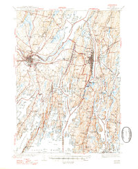
1945 Map of Bath
USGS Topo · Published 1947About this map
The maritime identity of mid-coast Maine is clearly defined on this mid-1940s survey, where the confluence of the Androscoggin River and Kennebec River forms the expansive Merrymeeting Bay. The city of Bath serves as the focal point, its industrial footprint including the Maine Central railroad corridors and proximity to resources like Dana Mill. The landscape is a complex of peninsulas and islands, with Sebascodegan Island and Orrs Island sheltering numerous coves and sounds.
Find a feature on this map
157 named features on this map. Tap any name to fly to it.
Don’t see what you’re looking for? This feature index may not catch every label — zoom into the map to look around manually.
Map Details
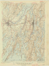
Editions of this 1945 Bath Map
2 editions found
Other maps of this area

1892 · Gardiner
USGS Topo · 1:62,500

1892 · Freeport
USGS Topo · 1:62,500

1893 · Small Point
USGS Topo · 1:62,500

1893 · Casco Bay
USGS Topo · 1:62,500

1893 · Wiscasset
USGS Topo · 1:62,500

1893 · Boothbay
USGS Topo · 1:62,500

1894 · Bath
USGS Topo · 1:62,500

1908 · Lewiston
USGS Topo · 1:62,500

1914 · Casco Bay
USGS Topo · 1:48,000

1916 · Casco Bay
USGS Topo · 1:62,500