
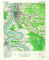
1956 Map of Baton Rouge
USGS Topo · Published 1956About this map
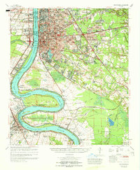
The Baton Rouge skyline is dominated by the Capitol on this mid-century survey, which reveals the complex geography of the Mississippi River and its surrounding bayous. The river forms dramatic loops and oxbows, including the prominent False River and Raccourci Old River, signaling a landscape shaped by shifting water courses. Industrial development is visible through numerous Oil wells scattered across the Atchafalaya Basin and the river banks, while the presence of Profit Island and Cat Island highlights the intricate island-and-channel network north of the city.
Find a feature on this map
129 named features on this map. Tap any name to fly to it.
Don’t see what you’re looking for? This feature index may not catch every label — zoom into the map to look around manually.
Map Details
Editions of this 1956 Baton Rouge Map
This is the sole edition of this map. No revisions or reprints were ever made.
Historical Maps of New Orleans Through Time
9 maps found
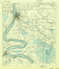
1908 Baton Rouge
East Baton Rouge Parish, LA
1939 Baton Rouge
East Baton Rouge Parish, LA
1954 Baton Rouge
East Baton Rouge Parish, LA
1956 Baton Rouge
East Baton Rouge Parish, LA

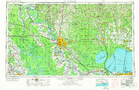
1961 Baton Rouge
East Baton Rouge Parish, LA

1962 Baton Rouge
East Baton Rouge Parish, LA
1963 Baton Rouge
East Baton Rouge Parish, LA
1965 Baton Rouge
East Baton Rouge Parish, LA

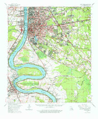
1984 Baton Rouge
East Baton Rouge Parish, LA