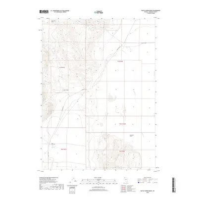
2018 Map of Battle Creek Ranch
USGS Topo · Published 2018About this map
Battle Creek Ranch sits at the western base of the high country, where the steep elevations of the Black Rock Range descend into the northern margins of the Black Rock Desert. This 2018 survey illustrates the remote ranching landscape of Humboldt County, defined by seasonal watercourses like Bottle Cr and Bartlett Cr that drain the canyons. The primary corridor through this arid terrain is Leonard Creek Rd, which skirts the edge of the range and provides access to localized water sources such as House Spring. The geography is marked by sharp relief, notably at Pearl Canyon and Rough Canyon, showing the transition from the rugged mountain peaks to the flat, expansive alkali flats of the desert floor.
Find a feature on this map
15 named features on this map. Tap any name to fly to it.
Don’t see what you’re looking for? This feature index may not catch every label — zoom into the map to look around manually.
Map Details
Editions of this 2018 Battle Creek Ranch Map
This is the sole edition of this map. No revisions or reprints were ever made.
Other maps of this area

1886 · Disaster
USGS Topo · 1:250,000

1893 · Disaster
USGS Topo · 1:250,000

1954 · Vya
USGS Topo · 1:250,000

1958 · Vya
USGS Topo · 1:250,000

1962 · Vya
USGS Topo · 1:250,000

1965 · Idaho Canyon
USGS Topo · 1:62,500

1965 · Duffer Peak
USGS Topo · 1:62,500

1972 · Pinto Mountain
USGS Topo · 1:24,000

1972 · Burnt Springs
USGS Topo · 1:24,000

1972 · Leonard Cr. Slough North
USGS Topo · 1:24,000