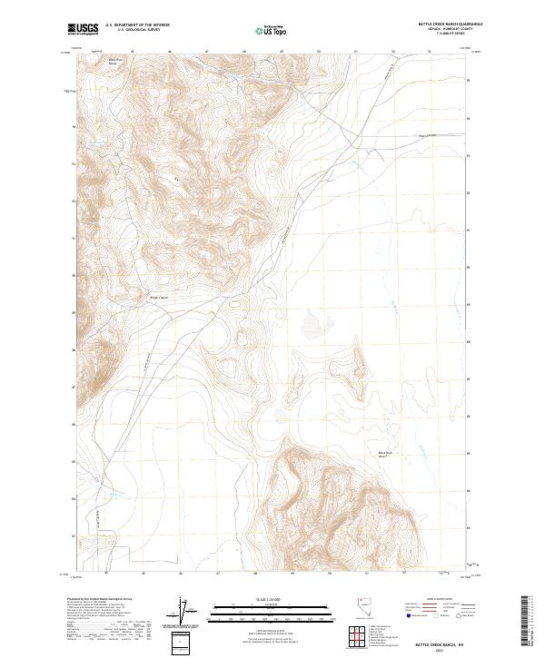
2021 Map of Battle Creek Ranch
USGS Topo · Published 2021About this map
Black Rock Range dominates the northwestern portion of this Humboldt County survey, giving way to the high desert plains and canyons of northwestern Nevada. The landscape is defined by its drainage systems, including the southward-flowing Leonard Cr and its namesake ranch area, alongside Battle Cr and Bartlett Cr. These watercourses have historically dictated movement and land use in this arid region, providing critical resources for the local ranching economy. The primary artery through this terrain is Leonard Creek Rd, which skirts the edge of the mountains and connects the rugged highlands to the more level expanses of the Black Rock Desert in the southeast. Smaller topographic features such as Pearl Canyon, Rough Canyon, and the isolated House Spring offer specific landmarks for those studying the physical geography and ranching boundaries of this remote territory.
Find a feature on this map
14 named features on this map. Tap any name to fly to it.
Don’t see what you’re looking for? This feature index may not catch every label — zoom into the map to look around manually.
Map Details
Editions of this 2021 Battle Creek Ranch Map
This is the sole edition of this map. No revisions or reprints were ever made.
Other maps of this area

1886 · Disaster
USGS Topo · 1:250,000

1893 · Disaster
USGS Topo · 1:250,000

1954 · Vya
USGS Topo · 1:250,000

1958 · Vya
USGS Topo · 1:250,000

1962 · Vya
USGS Topo · 1:250,000

1965 · Idaho Canyon
USGS Topo · 1:62,500

1965 · Duffer Peak
USGS Topo · 1:62,500

1972 · Pinto Mountain
USGS Topo · 1:24,000

1972 · Burnt Springs
USGS Topo · 1:24,000

1972 · Leonard Cr. Slough North
USGS Topo · 1:24,000