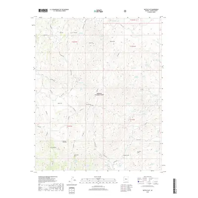
2018 Map of Battle Flat
USGS Topo · Published 2018About this map
Prescott National Forest encompasses this high-altitude landscape in the southern Bradshaw Mountains, where the history of Arizona mining and ranching is etched into the terrain. The small settlements of Pine Flat and Battle Flat serve as focal points in an area defined by steep drainages and isolated springs. The map documents an extensive network of resource-access roads, including the Peck Mine Rd and Swastika Mine Rd, which hint at the region's mineral extraction heritage. Between the heights of Tuscumbia Mtn and Brady Butte, the landscape is carved by numerous gulches with evocative names like Poor Mans Gulch and Wild Flower Gulch. Water is a critical resource in this arid environment, marked by a system of tanks and springs such as Boulder Dam Tank and Coyote Spring that support both local wildlife and cattle operations.
Find a feature on this map
71 named features on this map. Tap any name to fly to it.
Don’t see what you’re looking for? This feature index may not catch every label — zoom into the map to look around manually.
Map Details
Editions of this 2018 Battle Flat Map
This is the sole edition of this map. No revisions or reprints were ever made.
Other maps of this area

1887 · Prescott
USGS Topo · 1:250,000

1892 · Prescott
USGS Topo · 1:250,000

1903 · Bradshaw Mountains
USGS Topo · 1:125,000

1947 · Crown King
USGS Topo · 1:62,500

1947 · Bumblebee
USGS Topo · 1:62,500

1947 · Mayer
USGS Topo · 1:62,500

1947 · Mt. Union
USGS Topo · 1:62,500

1948 · Bumblebee
USGS Topo · 1:63,360

1948 · Crown King
USGS Topo · 1:63,360

1948 · Mt. Union
USGS Topo · 1:63,360