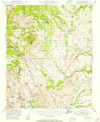
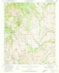
1947 Map of Mayer
USGS Topo · Published 1955About this map
Mining operations and cattle ranching dominate this mid-century survey of the Prescott National Forest interior. The rugged topography is etched with the names of numerous extraction sites, including the Pick & Drill Mine, Blue Bell Mine, and the Golden Turkey Mine near Townsend Butte. These claims are serviced by the A T & S F RR corridor, which cuts through the community of Mayer in the northwest. The drainage patterns of the Agua Fria River and its tributaries, such as Antelope Creek and Sycamore Creek, define the landscape, while scattered outposts like the Quarter Circle V Bar Ranch and Griffin and Bennett Ranch highlight the region's enduring ranching history. The map also captures small settlements like Cleator and Cordes during a period of active resource management and rural development.
Find a feature on this map
77 named features on this map. Tap any name to fly to it.
Don’t see what you’re looking for? This feature index may not catch every label — zoom into the map to look around manually.
Map Details
Editions of this 1947 Mayer Map
2 editions found
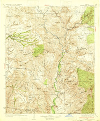
Other maps of this area

1887 · Verde
USGS Topo · 1:250,000

1887 · Prescott
USGS Topo · 1:250,000

1892 · Verde
USGS Topo · 1:250,000

1892 · Prescott
USGS Topo · 1:250,000

1903 · Bradshaw Mountains
USGS Topo · 1:125,000

1905 · Jerome
USGS Topo · 1:125,000

1923 · Camp Verde
USGS Topo · 1:125,000

1929 · Turret Peak
USGS Topo · 1:125,000

1932 · Camp Verde
USGS Topo · 1:125,000
1933 · Turret Peak
USGS Topo · 1:125,000