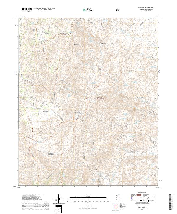
2021 Map of Battle Flat
USGS Topo · Published 2021About this map
Prescott National Forest encompasses the high desert and mountainous terrain of this region, where the Bradshaw Mountains dominate the southern landscape. The settlement of Battle Flat and the high-elevation Pine Flat serve as primary points of interest, connected by a network of forest roads and historic trails. The map reveals the area's mining legacy through access routes like Peck Mine Rd and Swastika Mine Rd, which wind through steep drainages including Muldoon Gulch and Poor Mans Gulch. Water is a critical and sparse resource here, marked by numerous isolated improvements such as Crooked Leg Tank, Mineral Cr Dam Tank, and The Troughs Spring. The presence of landmarks like Tuscumbia Mtn and Brady Butte defines the verticality of the terrain, while routes like Crown King Rd indicate the historical connectivity required to navigate these remote reaches of Arizona.
Find a feature on this map
80 named features on this map. Tap any name to fly to it.
Don’t see what you’re looking for? This feature index may not catch every label — zoom into the map to look around manually.
Map Details
Editions of this 2021 Battle Flat Map
This is the sole edition of this map. No revisions or reprints were ever made.
Other maps of this area

1887 · Prescott
USGS Topo · 1:250,000

1892 · Prescott
USGS Topo · 1:250,000

1903 · Bradshaw Mountains
USGS Topo · 1:125,000

1947 · Crown King
USGS Topo · 1:62,500

1947 · Bumblebee
USGS Topo · 1:62,500

1947 · Mayer
USGS Topo · 1:62,500

1947 · Mt. Union
USGS Topo · 1:62,500

1948 · Bumblebee
USGS Topo · 1:63,360

1948 · Crown King
USGS Topo · 1:63,360

1948 · Mt. Union
USGS Topo · 1:63,360