
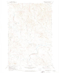
1969 Map of Battleship Rock
USGS Topo · Published 1971About this map
Slim Buttes dominate the center of this Harding County landscape, rising above the surrounding plains of the Custer National Forest. This late 1960s survey documents a region defined by high-plains ranching and specialized land use, including the State Experiment Farm and Antelope Reserve in the southwest. A network of springs, such as Little Joe Spring and Puckeroo Spring, provide essential water sources for the cattle operations at Olson Ranch, Lermeny Ranch, and Helms Ranch. The topographic character of the buttes is marked by notable landmarks like the namesake Battleship Rock, the narrow Reva Gap, and Window Rock. Human activity in the area ranges from the industrial residue of the Ivers Mine to the recreational Reva Campground, while a primitive Landing Strip and the North End Road facilitate movement through this sparsely populated territory.
Find a feature on this map
54 named features on this map. Tap any name to fly to it.
Don’t see what you’re looking for? This feature index may not catch every label — zoom into the map to look around manually.
Map Details
Editions of this 1969 Battleship Rock Map
This is the sole edition of this map. No revisions or reprints were ever made.
Other maps of this area

1935 · Reva
USGS Topo · 1:125,000

1935 · Hoover
USGS Topo · 1:125,000

1954 · Lemmon
USGS Topo · 1:250,000

1957 · Lemmon
USGS Topo · 1:250,000

1968 · J B Hill
USGS Topo · 1:24,000

1968 · Reva
USGS Topo · 1:24,000

1968 · Flat Top Butte
USGS Topo · 1:24,000

1969 · Reva NW
USGS Topo · 1:24,000

1969 · Reva NE
USGS Topo · 1:24,000
1971 · Sheep Pen Draw
USGS Topo · 1:24,000