
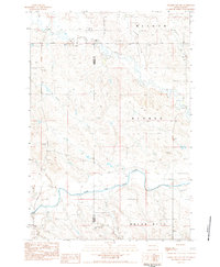
1969 Map of Reva NE
USGS Topo · Published 1971About this map
The South Fork Grand River meanders across this rural Harding County landscape, defining a region where water sources dictate the placement of ranching infrastructure. During the late 1960s, the area maintained a sparse network of essential landmarks, including St Isidore Cem and the Clark Sch, which served the scattered residents of the northern plains. The presence of the Wagner Ranch, accompanied by its own Landing Strip, highlights the reliance on private aviation for connecting remote ranching operations to larger trade centers.
Find a feature on this map
13 named features on this map. Tap any name to fly to it.
Don’t see what you’re looking for? This feature index may not catch every label — zoom into the map to look around manually.
Map Details
Editions of this 1969 Reva NE Map
This is the sole edition of this map. No revisions or reprints were ever made.
Other maps of this area

1935 · Reva
USGS Topo · 1:125,000

1954 · Lemmon
USGS Topo · 1:250,000

1957 · Lemmon
USGS Topo · 1:250,000

1968 · Reva
USGS Topo · 1:24,000

1968 · Ralph SW
USGS Topo · 1:24,000

1968 · Ralph
USGS Topo · 1:24,000

1969 · Battleship Rock
USGS Topo · 1:24,000

1969 · Reva NW
USGS Topo · 1:24,000

1980 · Camp Crook
USGS Topo · 1:100,000
1983 · Prairie City NW
USGS Topo · 1:24,000