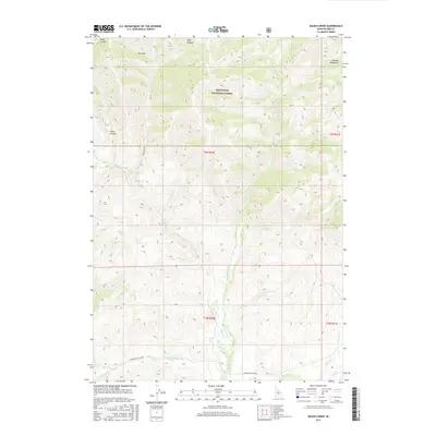
2017 Map of Baugh Creek
USGS Topo · Published 2017About this map
The Little Wood River carves a central drainage through this Idaho high-country landscape, where the Sawtooth National Forest meets the southern reaches of the Pioneer Mountains. The terrain is defined by a series of steep drainages including Fisher Canyon, Dry Draw, and Drop Canyon, illustrating the complex watershed that feeds the local creek systems. Early 21st-century access is provided by unpaved routes such as Porcupine Rd and Muldoon Canyon Rd, which navigate the foothills and canyons.
Find a feature on this map
29 named features on this map. Tap any name to fly to it.
Don’t see what you’re looking for? This feature index may not catch every label — zoom into the map to look around manually.
Map Details
Editions of this 2017 Baugh Creek Map
This is the sole edition of this map. No revisions or reprints were ever made.
Other maps of this area

1895 · Hailey
USGS Topo · 1:125,000

1897 · Hailey
USGS Topo · 1:125,000

1935 · MacKay
USGS Topo · 1:96,000

1955 · Idaho Falls
USGS Topo · 1:250,000

1955 · Hailey
USGS Topo · 1:250,000

1958 · Idaho Falls
USGS Topo · 1:250,000

1959 · Hailey
USGS Topo · 1:250,000

1960 · Muldoon Canyon
USGS Topo · 1:62,500

1962 · Hailey
USGS Topo · 1:250,000

1967 · Baugh Creek SW
USGS Topo · 1:24,000