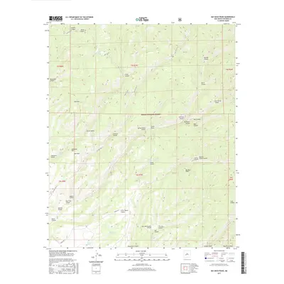
2017 Map of Bay Buck Peaks
USGS Topo · Published 2017About this map
Cibola National Forest encompasses the entirety of this high-elevation terrain, characterized by a complex network of drainages and prominent volcanic landforms. The topographic relief is anchored by the Bay Buck Peaks and Alexander Mtn, with a series of major canyons like Sawmill Canyon and Bear Trap Canyon cutting through the landscape. Human activity is evidenced primarily by infrastructure for livestock and forestry, including Baney Park Tank and Trough Spring. The historical transportation corridor of Old State Hwy 52 winds through the central valleys, providing access to remote points such as Turkey Saddle and Hay Ground Draw. This map documents the essential water sources and naming conventions that have defined land use in this part of Socorro County for generations of ranchers and foresters.
Find a feature on this map
52 named features on this map. Tap any name to fly to it.
Don’t see what you’re looking for? This feature index may not catch every label — zoom into the map to look around manually.
Map Details
Editions of this 2017 Bay Buck Peaks Map
This is the sole edition of this map. No revisions or reprints were ever made.
Other maps of this area

1954 · Tularosa
USGS Topo · 1:250,000

1958 · Tularosa
USGS Topo · 1:250,000

1964 · Welty Hill
USGS Topo · 1:24,000

1964 · Bay Buck Peaks
USGS Topo · 1:24,000

1964 · Blue Mountain
USGS Topo · 1:24,000
1964 · Grassy Lookout
USGS Topo · 1:24,000

1964 · Monica Saddle
USGS Topo · 1:24,000

1965 · Oak Peak
USGS Topo · 1:24,000
1965 · Kellog Well
USGS Topo · 1:24,000

1965 · Dusty
USGS Topo · 1:24,000