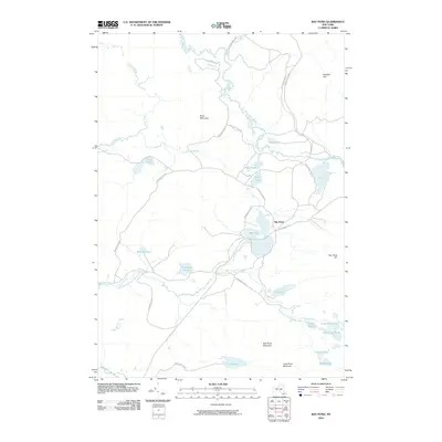
2010 Map of Bay Pond
USGS Topo · Published 2010About this map
Saint Regis River and its West Branch meander through this northern reach of Adirondack Park, defining a landscape of interconnected water bodies and isolated peaks. The small settlement at Bay Pond sits as a primary point of human activity, accessed via Keeses Mills Rd and Blue Mountain Rd. This area is characterized by its complex hydrology, where Ghost Brook and Long Pond Outlet link numerous named ponds, including Bear Pond, Black Pond, and the grouped Little Fish Pond and Little Long Pond to the southeast.
Find a feature on this map
29 named features on this map. Tap any name to fly to it.
Don’t see what you’re looking for? This feature index may not catch every label — zoom into the map to look around manually.
Map Details
Editions of this 2010 Bay Pond Map
This is the sole edition of this map. No revisions or reprints were ever made.
Other maps of this area

1905 · Saint Regis
USGS Topo · 1:62,500

1919 · Nicholville
USGS Topo · 1:62,500

1920 · Childwold
USGS Topo · 1:62,500

1921 · Childwold
USGS Topo · 1:48,000

1921 · Nicholville
USGS Topo · 1:62,500

1921 · Santa Clara
USGS Topo · 1:62,500

1922 · Childwold
USGS Topo · 1:62,500

1923 · Santa Clara
USGS Topo · 1:62,500

1948 · Ogdensburg
USGS Topo · 1:250,000

1951 · Ogdensburg
USGS Topo · 1:250,000