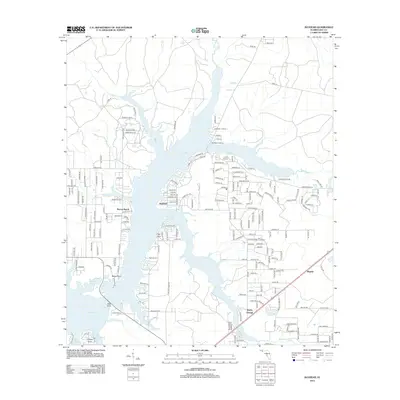
2012 Map of Bayhead
USGS Topo · Published 2012About this map
Deer Point Lake dominates the central landscape of this 2012 survey, its expansive waters fed by Econfina Cr and Long Br. Residential developments and small settlements dot the shoreline, including Bayhead, Resota Beach, and High Point. These communities are connected by a dense network of local roads such as Cedar Bluff Rd and Hitchcock Rd, reflecting the suburban expansion north of Panama City.
Find a feature on this map
179 named features on this map. Tap any name to fly to it.
Don’t see what you’re looking for? This feature index may not catch every label — zoom into the map to look around manually.
Map Details
Editions of this 2012 Bayhead Map
This is the sole edition of this map. No revisions or reprints were ever made.
Other maps of this area

1943 · Panama City
USGS Topo · 1:31,680

1943 · Southport
USGS Topo · 1:24,000

1944 · Southport
USGS Topo · 1:24,000

1944 · Crystal Lake
USGS Topo · 1:24,000

1944 · Bayhead
USGS Topo · 1:24,000

1944 · Bennett
USGS Topo · 1:24,000

1945 · Youngstown
USGS Topo · 1:31,680

1945 · Bennett
USGS Topo · 1:31,680

1945 · Bayhead
USGS Topo · 1:31,680

1945 · North Of Allanton
USGS Topo · 1:31,680