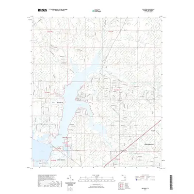
2021 Map of Bayhead
USGS Topo · Published 2021About this map
Deer Point Lake dominates this coastal landscape north of Panama City, where the intricate fingers of North Bay and numerous bayous meet the Florida mainland. The transition from established residential areas in Lynn Haven and College Point to the more dispersed communities of Resota Beach and Bayhead reflects the region's suburban expansion around the water. The mapping of the Econfina Creek Paddling Trl and the dense network of local roads like Co RD 388 and Co RD 2321 highlights a modern era focused on both recreation and residential connectivity. In the eastern reaches, smaller settlements like Majette and Bayou George sit near the winding course of Bear Creek, illustrating how the natural geography of the bayou system continues to dictate the footprint of local development and land use in Bay County.
Find a feature on this map
102 named features on this map. Tap any name to fly to it.
Don’t see what you’re looking for? This feature index may not catch every label — zoom into the map to look around manually.
Map Details
Editions of this 2021 Bayhead Map
This is the sole edition of this map. No revisions or reprints were ever made.
Other maps of this area

1943 · Panama City
USGS Topo · 1:31,680

1943 · Southport
USGS Topo · 1:24,000

1944 · Southport
USGS Topo · 1:24,000

1944 · Crystal Lake
USGS Topo · 1:24,000

1944 · Bayhead
USGS Topo · 1:24,000

1944 · Bennett
USGS Topo · 1:24,000

1945 · Youngstown
USGS Topo · 1:31,680

1945 · Bennett
USGS Topo · 1:31,680

1945 · Bayhead
USGS Topo · 1:31,680

1945 · North Of Allanton
USGS Topo · 1:31,680