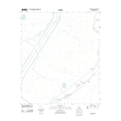
2012 Map of Bayland SE
USGS Topo · Published 2012About this map
Limerick sits at the heart of this riverine landscape, where the Yazoo River defines the southern reach of the Delta. This area is characterized by an intricate network of landings and bayous that once served as the primary conduits for commerce and communication. Historic river access points like Sherrards Old Landing, Rough and Ready Landing, and Pauls Landing trace the shifting banks of the river, marking the locations of former docks and steamboat stops. The presence of multiple family-named burial grounds, including John Roberson Cem and Banks Cem, provides a map of the local genealogy and settlement patterns. Further inland, the landscape is segmented by engineering features like Whittington W Levee Rd and Whittington E Levee Rd, which parallel water bodies like Deep Bayou and Five Mile Lake, illustrating the ongoing effort to manage the Delta's natural drainage.
Find a feature on this map
30 named features on this map. Tap any name to fly to it.
Don’t see what you’re looking for? This feature index may not catch every label — zoom into the map to look around manually.
Map Details
Editions of this 2012 Bayland SE Map
This is the sole edition of this map. No revisions or reprints were ever made.
Other maps of this area

1940 · Mechanicsburg
USGS Topo · 1:62,500

1955 · Jackson
USGS Topo · 1:250,000

1961 · Jackson
USGS Topo · 1:250,000

1961 · Bayland
USGS Topo · 1:62,500

1961 · Valley
USGS Topo · 1:62,500

1962 · Jackson
USGS Topo · 1:250,000

1962 · Flora
USGS Topo · 1:62,500

1963 · Mechanicsburg
USGS Topo · 1:62,500

1984 · Yazoo City
USGS Topo · 1:100,000
1988 · Lucre
USGS Topo · 1:24,000