
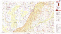
1984 Map of Yazoo City
USGS Topo · Published 1984About this map
The Yazoo River dominates this mid-1980s landscape, winding through a complex system of waterways and protected wetlands in the Mississippi Delta. The transition from the flat alluvial plain to the loess bluffs is sharp near Yazoo City, where the Illinois Central Gulf Railroad runs along the base of the hills. Large tracts of conservation land characterize the region, including the Delta National Forest and the Panther Swamp National Wildlife Area, indicating the environmental significance of this riverine ecosystem. Smaller settlements like Mechanicsburg, Holly Bluff, and Satartia are scattered throughout the lowland reaches, connected by a network of drainage canals and bayous such as Steele Bayou and the Auxiliary Channel. The map reveals the intricate water management of the basin, from the Big Sunflower River to the Big Black River, highlighting a landscape shaped by both natural flooding and extensive engineering.
Find a feature on this map
113 named features on this map. Tap any name to fly to it.
Don’t see what you’re looking for? This feature index may not catch every label — zoom into the map to look around manually.
Map Details
Editions of this 1984 Yazoo City Map
2 editions found
Other maps of this area

1903 · Jackson
USGS Topo · 1:125,000

1905 · Jackson
USGS Topo · 1:48,000

1908 · Jackson
USGS Topo · 1:62,500

1909 · Millikens Bend
USGS Topo · 1:24,000

1909 · Wilsons Point
USGS Topo · 1:24,000

1913 · Wilson Point
USGS Topo · 1:31,680

1918 · Vicksburg
USGS Topo · 1:62,500

1922 · Pelahatchee
USGS Topo · 1:48,000

1924 · Pelahatchee
USGS Topo · 1:62,500

1934 · Raymond
USGS Topo · 1:48,000