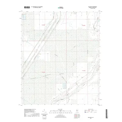
2018 Map of Bayland SE
USGS Topo · Published 2018About this map
Limerick lies at the heart of this Yazoo County landscape, where the agricultural rhythms of the Mississippi Delta meet a complex network of bayous and drainage channels. The Yazoo River defines the southern boundary, its meandering course shadowed by the Oak Valley Cem. To the north, the terrain is shaped by water management efforts like the Will M Whittington Auxiliary Channel and the Whittington East Levee Rd, infrastructure critical to protecting the low-lying plains from seasonal flooding. Significant family and community history is preserved in small burial grounds such as the Mayday Cem, John Roberson Cem, and Banks Cem near Tokeba Bayou. A web of service roads and industrial features, including the Southern Natural Gas Pipeline and Powerline Road, crisscross the wetlands, reflecting the modern utility footprint upon an area historically dominated by water bodies like Five Mile Lake and Deep Bayou.
Find a feature on this map
32 named features on this map. Tap any name to fly to it.
Don’t see what you’re looking for? This feature index may not catch every label — zoom into the map to look around manually.
Map Details
Editions of this 2018 Bayland SE Map
This is the sole edition of this map. No revisions or reprints were ever made.
Other maps of this area

1940 · Mechanicsburg
USGS Topo · 1:62,500

1955 · Jackson
USGS Topo · 1:250,000

1961 · Jackson
USGS Topo · 1:250,000

1961 · Bayland
USGS Topo · 1:62,500

1961 · Valley
USGS Topo · 1:62,500

1962 · Jackson
USGS Topo · 1:250,000

1962 · Flora
USGS Topo · 1:62,500

1963 · Mechanicsburg
USGS Topo · 1:62,500

1984 · Yazoo City
USGS Topo · 1:100,000
1988 · Lucre
USGS Topo · 1:24,000