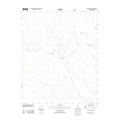
2012 Map of Bear Canyon
USGS Topo · Published 2012About this map
The San Antonio River carves a central path through this Monterey County landscape, serving as the primary drainage for a network of seasonal streams and deep-cut terrain. In the early 21st century, this area remains characterized by isolated outposts like Avila Ranch and a series of water management features including Milpitas Reservoir and Coleman Reservoir. The drainage pattern is complex, with Mission Cr and Forest Cr feeding into the main river valley near significant topographical landmarks like Rudolph Ridge. The presence of named geographic features such as China Gulch and Bear Canyon indicates a history of local nomenclature tied to the varied physical geography of the Coast Ranges. This USGS survey provides a detailed view of the infrastructure and natural water systems that sustain this rural interior portion of the state.
Find a feature on this map
11 named features on this map. Tap any name to fly to it.
Don’t see what you’re looking for? This feature index may not catch every label — zoom into the map to look around manually.
Map Details
Editions of this 2012 Bear Canyon Map
This is the sole edition of this map. No revisions or reprints were ever made.
Other maps of this area

1919 · King City
USGS Topo · 1:62,500

1919 · Junipero Serra
USGS Topo · 1:62,500

1919 · Bryson
USGS Topo · 1:62,500

1921 · Cape San Martin
USGS Topo · 1:62,500

1939 · King City
USGS Topo · 1:62,500

1941 · Cape San Martin
USGS Topo · 1:62,500

1941 · Junipero Serra
USGS Topo · 1:62,500

1941 · Bryson
USGS Topo · 1:62,500

1942 · Bryson
USGS Topo · 1:62,500

1942 · Cape San Martin
USGS Topo · 1:62,500