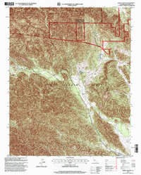
1995 Map of Bear Canyon
USGS Topo · Published 2001About this map
Fort Hunter Liggett dominates this landscape in the mid-1990s, where military training grounds overlap with historic Spanish-era land divisions. The terrain is defined by the San Antonio River as it winds through the Milpitas Grant and San Miguelito Grant. These land grants preserved large, contiguous tracts of territory that became central to the Fort Hunter Liggett Military Reservation.
Find a feature on this map
13 named features on this map. Tap any name to fly to it.
Don’t see what you’re looking for? This feature index may not catch every label — zoom into the map to look around manually.
Map Details
Editions of this 1995 Bear Canyon Map
This is the sole edition of this map. No revisions or reprints were ever made.
Other maps of this area

1919 · King City
USGS Topo · 1:62,500

1919 · Junipero Serra
USGS Topo · 1:62,500

1919 · Bryson
USGS Topo · 1:62,500

1921 · Cape San Martin
USGS Topo · 1:62,500

1939 · King City
USGS Topo · 1:62,500

1941 · Cape San Martin
USGS Topo · 1:62,500

1941 · Junipero Serra
USGS Topo · 1:62,500

1941 · Bryson
USGS Topo · 1:62,500

1942 · Bryson
USGS Topo · 1:62,500

1942 · Cape San Martin
USGS Topo · 1:62,500