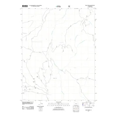
2011 Map of Bear Creek
USGS Topo · Published 2011About this map
Buckhorn Mine sits tucked into the drainage of Ute Log Gulch, a reminder of the extractive history that shaped this corner of Huerfano County. The landscape is defined by the headwaters and branches of the Saint Charles River and the complex drainage system of Williams Creek. To the east, the terrain rises toward the slopes of Greenhorn Mountain, while the southern reaches are marked by the meeting of the North Fork Bear Creek and South Fork Bear Creek to form Bear Creek. The network of backroads, including Gardner Rd and Co RD 630, traces the contours of deep depressions like Devils Hole. This 2011 survey documents a sparsely populated but geographically intricate area where ranching and mining infrastructure follow the natural paths carved by Wylie Gulch and Reed Gulch.
Find a feature on this map
32 named features on this map. Tap any name to fly to it.
Don’t see what you’re looking for? This feature index may not catch every label — zoom into the map to look around manually.
Map Details
Editions of this 2011 Bear Creek Map
This is the sole edition of this map. No revisions or reprints were ever made.
Other maps of this area

1889 · Canon City
USGS Topo · 1:125,000

1889 · Huerfano Park
USGS Topo · 1:125,000

1892 · Huerfano Park
USGS Topo · 1:125,000

1892 · Canon City
USGS Topo · 1:125,000

1954 · Rosita
USGS Topo · 1:24,000

1954 · Trinidad
USGS Topo · 1:250,000

1954 · Pueblo
USGS Topo · 1:250,000

1955 · Trinidad
USGS Topo · 1:250,000

1957 · Pueblo
USGS Topo · 1:250,000

1958 · Trinidad
USGS Topo · 1:250,000