
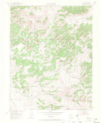
1954 Map of Rosita
USGS Topo · Published 1956About this map
Rosita Hills and the eastern slopes of the Wet Mountains define this mid-century landscape in Custer County. The settlement of Rosita sits at the base of several prominent peaks, including Paris Hill and Concord Hill, while the nearby community of Querida is located just north near Dutch Flat. The area's history of mining and quarrying is evidenced by the Perigo Quarry and numerous named gulches such as Democrat Gulch and Goodhope Gulch. Moving east into the San Isabel National Forest, the terrain opens into Junkins Park and the rugged slopes of Arkansas Mountain. Rural infrastructure is well-documented through features like the Antelope Sch and Junkins Park Sch, along with the Rosita Cem, providing essential touchstones for genealogists studying these high-altitude ranching and mining communities.
Find a feature on this map
39 named features on this map. Tap any name to fly to it.
Don’t see what you’re looking for? This feature index may not catch every label — zoom into the map to look around manually.
Map Details
Editions of this 1954 Rosita Map
4 editions found
Other maps of this area

1889 · Canon City
USGS Topo · 1:125,000

1889 · Huerfano Park
USGS Topo · 1:125,000

1892 · Huerfano Park
USGS Topo · 1:125,000

1892 · Canon City
USGS Topo · 1:125,000

1954 · Mount Tyndall
USGS Topo · 1:24,000

1954 · Trinidad
USGS Topo · 1:250,000

1954 · Pueblo
USGS Topo · 1:250,000

1955 · Westcliffe
USGS Topo · 1:24,000

1955 · Trinidad
USGS Topo · 1:250,000

1957 · Pueblo
USGS Topo · 1:250,000