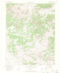
1954 Map of Rosita
USGS Topo · Published 1967About this map
The Wet Mountains provide the backdrop for this mid-century look at Custer County's mineral-rich landscape. Centered on the historic mining district of Rosita, the survey illustrates a terrain defined by high-altitude peaks like Mt Fairview and Paris Hill. By the early 1950s, the feverish silver boom days had cooled, yet the map remains dense with the nomenclature of that era, from Rosita Hills to the scattered settlements of Querida and Robinson.
Find a feature on this map
42 named features on this map. Tap any name to fly to it.
Don’t see what you’re looking for? This feature index may not catch every label — zoom into the map to look around manually.
Map Details
Editions of this 1954 Rosita Map
4 editions found
Other maps of this area

1889 · Canon City
USGS Topo · 1:125,000

1889 · Huerfano Park
USGS Topo · 1:125,000

1892 · Huerfano Park
USGS Topo · 1:125,000

1892 · Canon City
USGS Topo · 1:125,000

1954 · Mount Tyndall
USGS Topo · 1:24,000

1954 · Rosita
USGS Topo · 1:24,000

1954 · Trinidad
USGS Topo · 1:250,000

1954 · Pueblo
USGS Topo · 1:250,000

1955 · Westcliffe
USGS Topo · 1:24,000

1955 · Trinidad
USGS Topo · 1:250,000