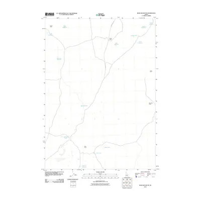
2010 Map of Bear Den Butte
USGS Topo · Published 2010About this map
Bear Den Butte and its surrounding volcanic landscape dominate this portion of Blaine County, where the topography is defined by distinct buttes and a network of reservoirs. The terrain is marked by prominent elevations including Potter Butte, Lava Butte, and the rising ground at Lava Point. This high-desert environment relies on a sophisticated system of water management, visible through numerous named catchments such as Bowl Reservoir, Monument Reservoir, and Moline Reservoir.
Find a feature on this map
19 named features on this map. Tap any name to fly to it.
Don’t see what you’re looking for? This feature index may not catch every label — zoom into the map to look around manually.
Map Details
Editions of this 2010 Bear Den Butte Map
This is the sole edition of this map. No revisions or reprints were ever made.
Other maps of this area

1955 · Idaho Falls
USGS Topo · 1:250,000

1958 · Idaho Falls
USGS Topo · 1:250,000

1972 · North Laidlaw Butte
USGS Topo · 1:24,000

1972 · Little Park
USGS Topo · 1:24,000

1972 · Bear Park SW
USGS Topo · 1:24,000

1972 · Laidlaw Lake
USGS Topo · 1:24,000

1972 · Bear Den Butte
USGS Topo · 1:24,000

1972 · Laidlaw Butte
USGS Topo · 1:24,000

1972 · Bottleneck Lake
USGS Topo · 1:24,000

1972 · Bear Park West
USGS Topo · 1:24,000