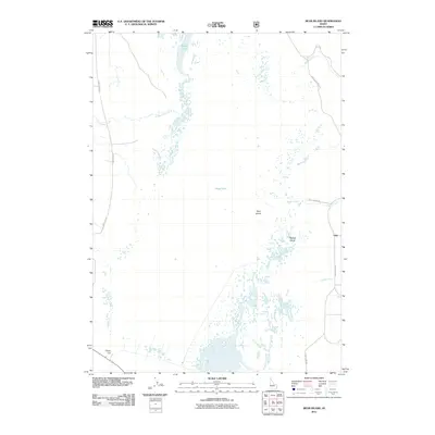
2011 Map of Bear Island
USGS Topo · Published 2011About this map
Grays Lake dominates this high-altitude wetlands landscape in Bonneville County, where seasonal waters and marshes surround the distinctive elevations of Bear Island and Bishop Island. The map illustrates a complex hydrological network feeding into the lake, including Willow Creek and Little Valley Creek from the north, and Eagle Creek, Bridge Creek, and Gravel Creek from the east and south. This environment is largely defined by the expanse of the lake bed itself, with very little human infrastructure beyond primary access routes like Grays Lake Rd and West Side Rd. A notable man-made feature, Clarks Cut, is visible in the southwestern corner, suggesting historical water management or drainage efforts in this unique Idaho basin. The sparse distribution of labels emphasizes the protected, natural character of the Grays Lake area in the early 21st century.
Find a feature on this map
12 named features on this map. Tap any name to fly to it.
Don’t see what you’re looking for? This feature index may not catch every label — zoom into the map to look around manually.
Map Details
Editions of this 2011 Bear Island Map
This is the sole edition of this map. No revisions or reprints were ever made.
Other maps of this area

1914 · Henry
USGS Topo · 1:48,000

1915 · Lanes Creek
USGS Topo · 1:62,500

1916 · Henry
USGS Topo · 1:62,500

1917 · Cranes Flat
USGS Topo · 1:62,500

1932 · Irwin
USGS Topo · 1:96,000

1935 · Irwin
USGS Topo · 1:125,000

1955 · Driggs
USGS Topo · 1:250,000

1955 · Preston
USGS Topo · 1:250,000

1958 · Driggs
USGS Topo · 1:250,000

1958 · Preston
USGS Topo · 1:250,000